

The Spirit of Community in Delano is defined by the
Creativity, Resilience, and Community Investment of its people.
Crow River Floods/Wagon Bridge
The first people to travel the Crow River were the Wahpekute (Shooters Among the Leaves) band of the Oceti Sakowin meaning Seven Council Fires, known as the Great Sioux Nation.
In 1853, Wright County was open to white settlement. Trappers, traders, farmers, and shopkeepers began to move into the Big Woods following the Crow River to the area which was to become Delano.
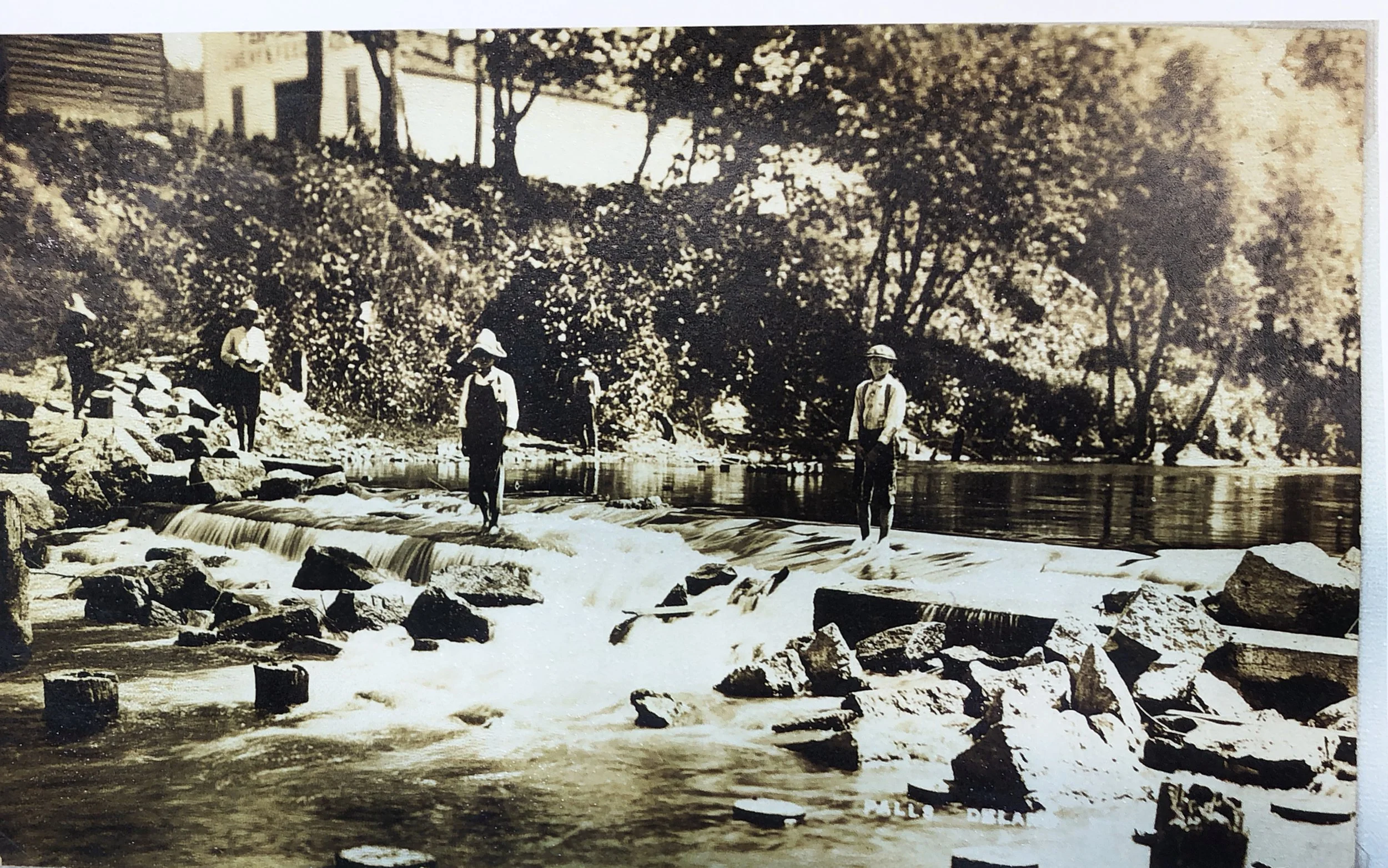
Although the river provided transportation, power and recreation, Delano has had a long history of high water, ice dams and flooding.
The Crow River Bridges provided a important link between settlements on both sides of the river when the water was not low enough to ford.
1868: First wooden bridge was built in Crow River (Delano) by the village, town proprietors and the township.
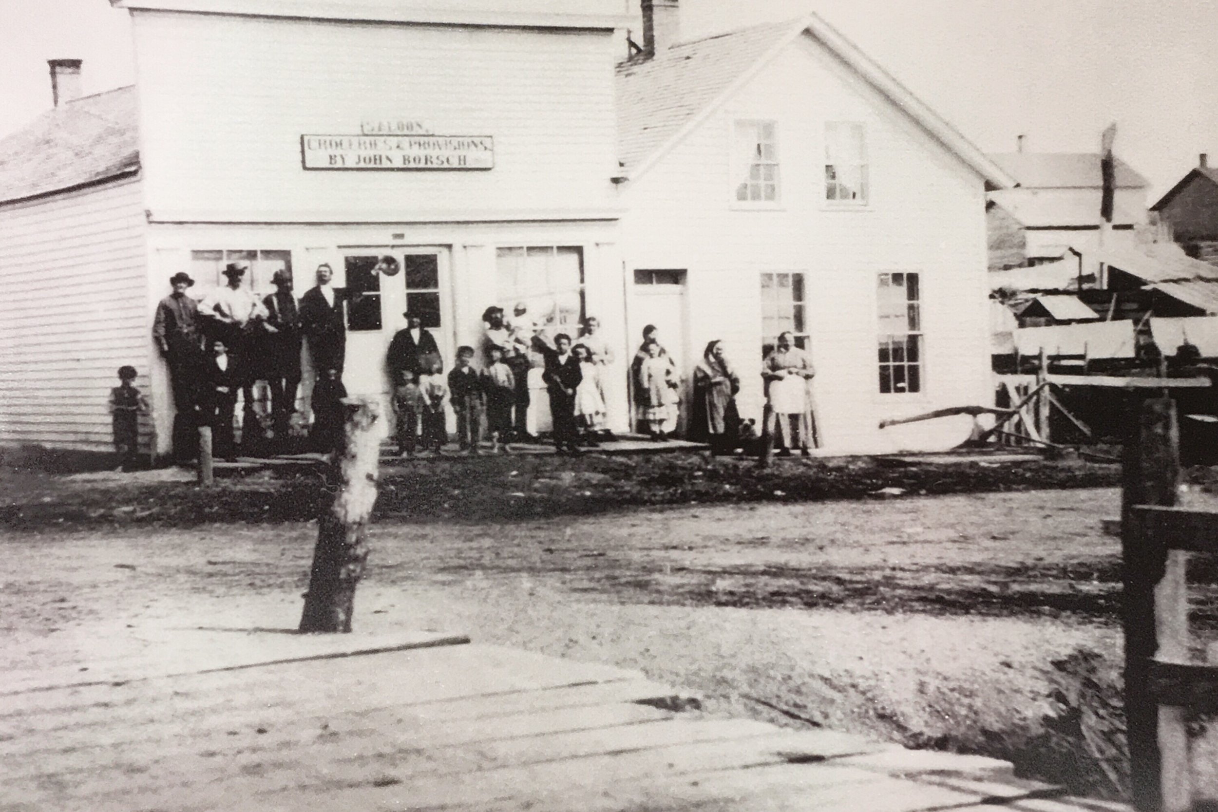
Borsch’s store was located at the corner of Bridge Avenue and River Street., facing the river. You can see the beginning of the wooden bridge, the first bridge built in Crow River (Delano.)
Built in the village of Delano in 1868, the village paying $150, the town proprietors about the same, and the township the remainder. In 1879 the bridge was entirely rebuilt. In 1882 it was repaired and replanked at a cost of about $230, of which the town paid $100 and the village the remainder.
The first wooden bridge over the Crow River in Delano can be seen in fore front of this photo circa 1868
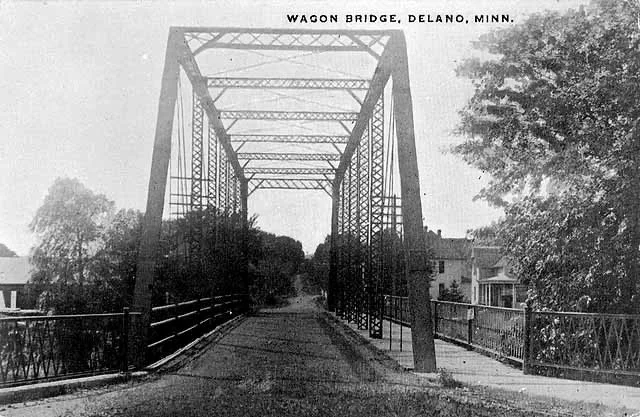
In 1887 a special election was held to vote on a proposition to rebuild the wooden bridge across the Crow River; the citizens vetoed it by a vote of 23 for and 50 against.
1888 – a special election was held and by a vote of 51 to 49 the proposition of expending $1000 to repair the wooden bridge was again rejected. Another special election was held three weeks later, to consider the matter of spending an amount not exceeding $4000 for an iron bridge. It was rejected by a vote of 85 to 67.
1889 – In April a special election was held to consider the matter of issuing bonds not exceeding $4000 to take up floating debt and to aid in construction of an iron bridge, the bridge not to exceed $2,500. It was rejected by a vote of 71 to 65. Another special election was held in May and by a vote of 115 to 8 it was decided to issue bonds amounting to $3,000 to cover the floating debt. By the end of the year the iron bridge across the Crow River was completed.
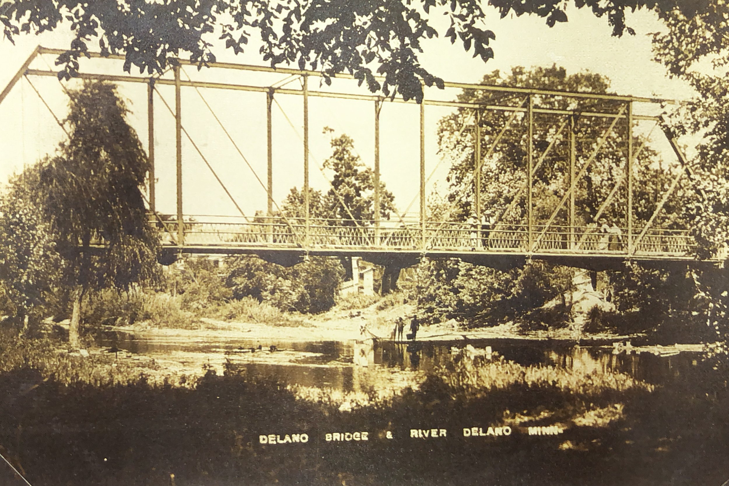
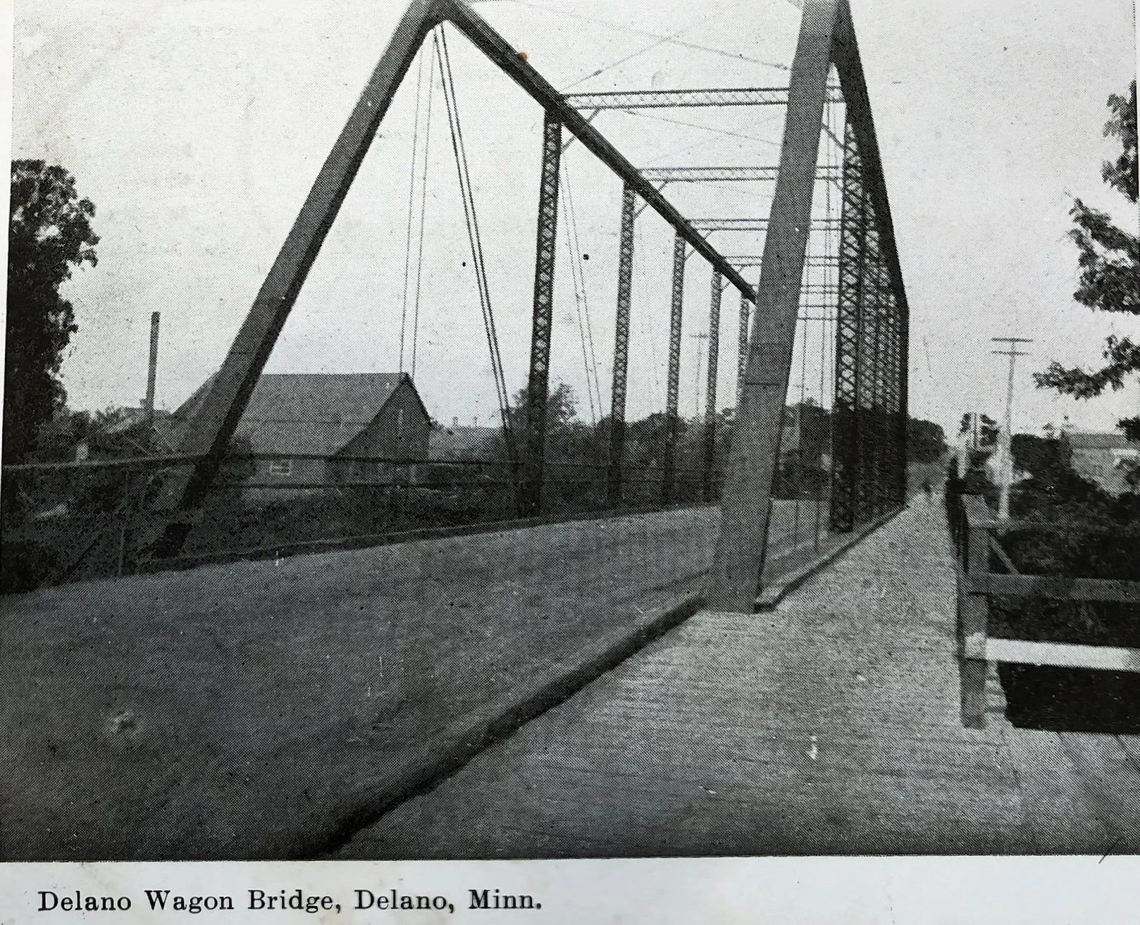
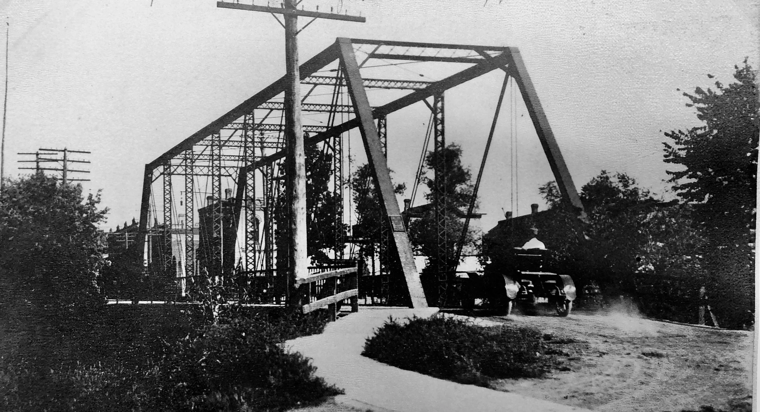
The wagon bridge allowed only one vehicle at a time to cross. It also had a pedestrian walkway on one side.
The 1952 flood waters covered all but a few inches of the wagon bridge. A new bridge had been sought by Delano on and off over the next 20 years when in January 1964, the Board of County Commissioners finally authorized its construction. Plans were made to move the wagon bridge a short distance upstream so that it could be used as a footbridge while the new structure was being completed.
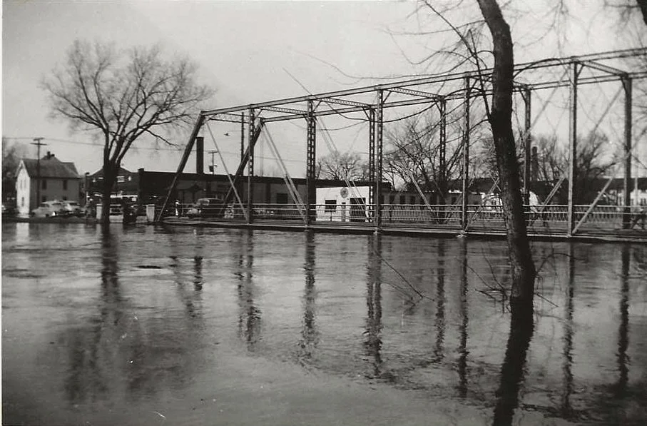
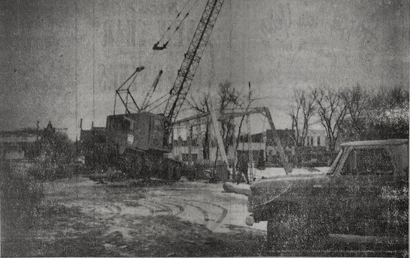
Delano’s historic old wagon bridge, which had withstood the battering of many floods, proved to be almost too much for the two giants cranes which moved it to provide a walkway across the river while the new bridge was being constructed. The weight of the bridge, while it was being moved, lifted the cranes four feet off the ground and almost resulted in the bridge being dropped into the river.
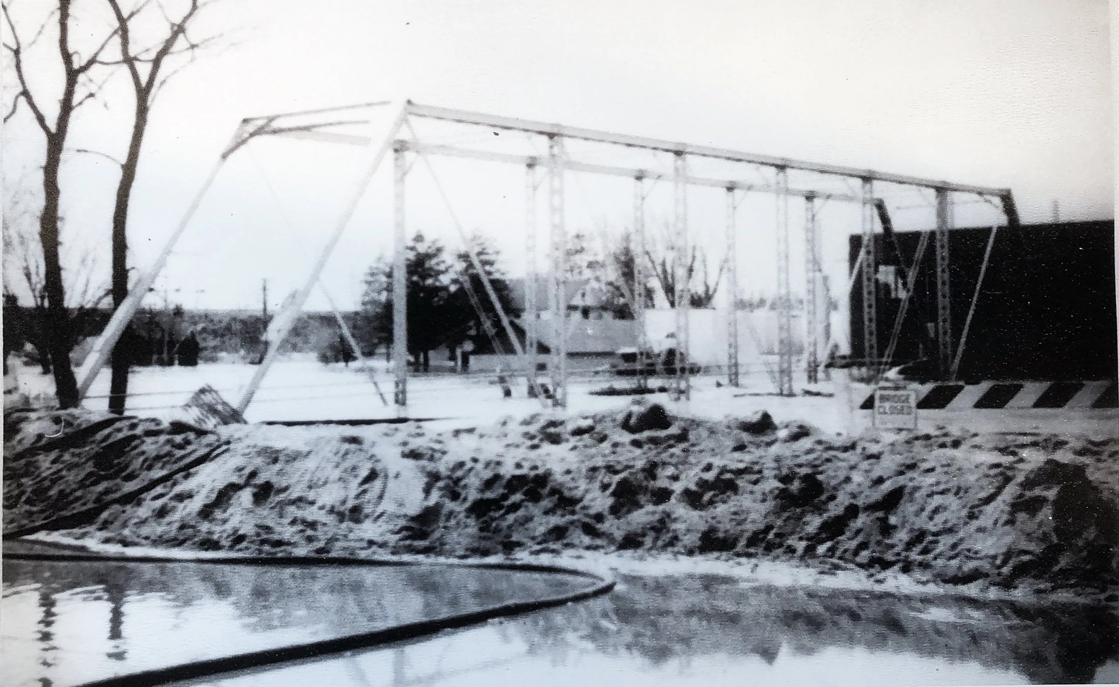
Here is the old wagon bridge during the 1965 flood. It was just resting temporarily on piles as the piers for the new bridge were already in place. There was the added concern that the floodwater would wash it away and damage the new piers.
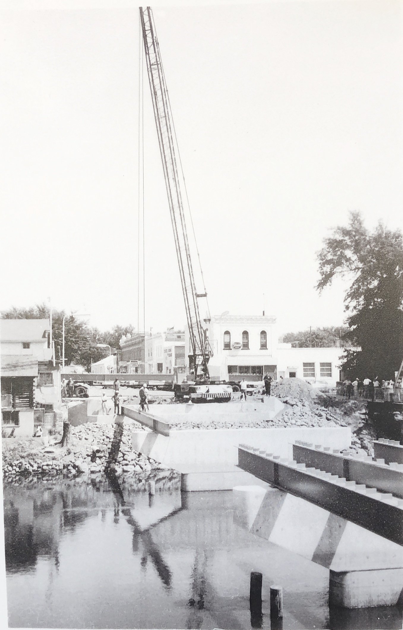
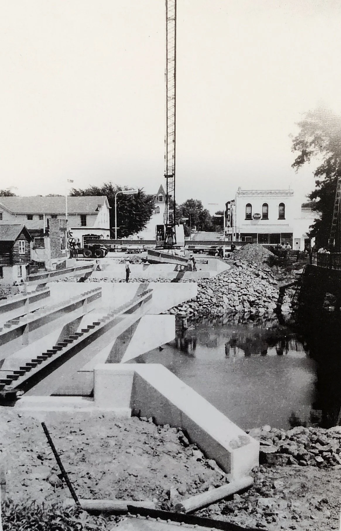
The new bridge was finished following the flood in 1965. It was officially opened on September 24, 1965, with a ribbon cutting ceremony. The celebration included talks by city officials, and visiting dignitaries, a drawing for grand prizes, a square dance exhibition on the new bridge, and finally having the bridge thrown open for public dancing.
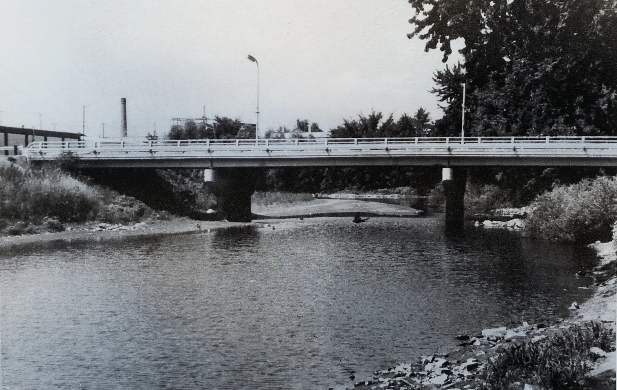
The new concrete bridge consists of a 30-foot roadway and two four-feet sidewalks.
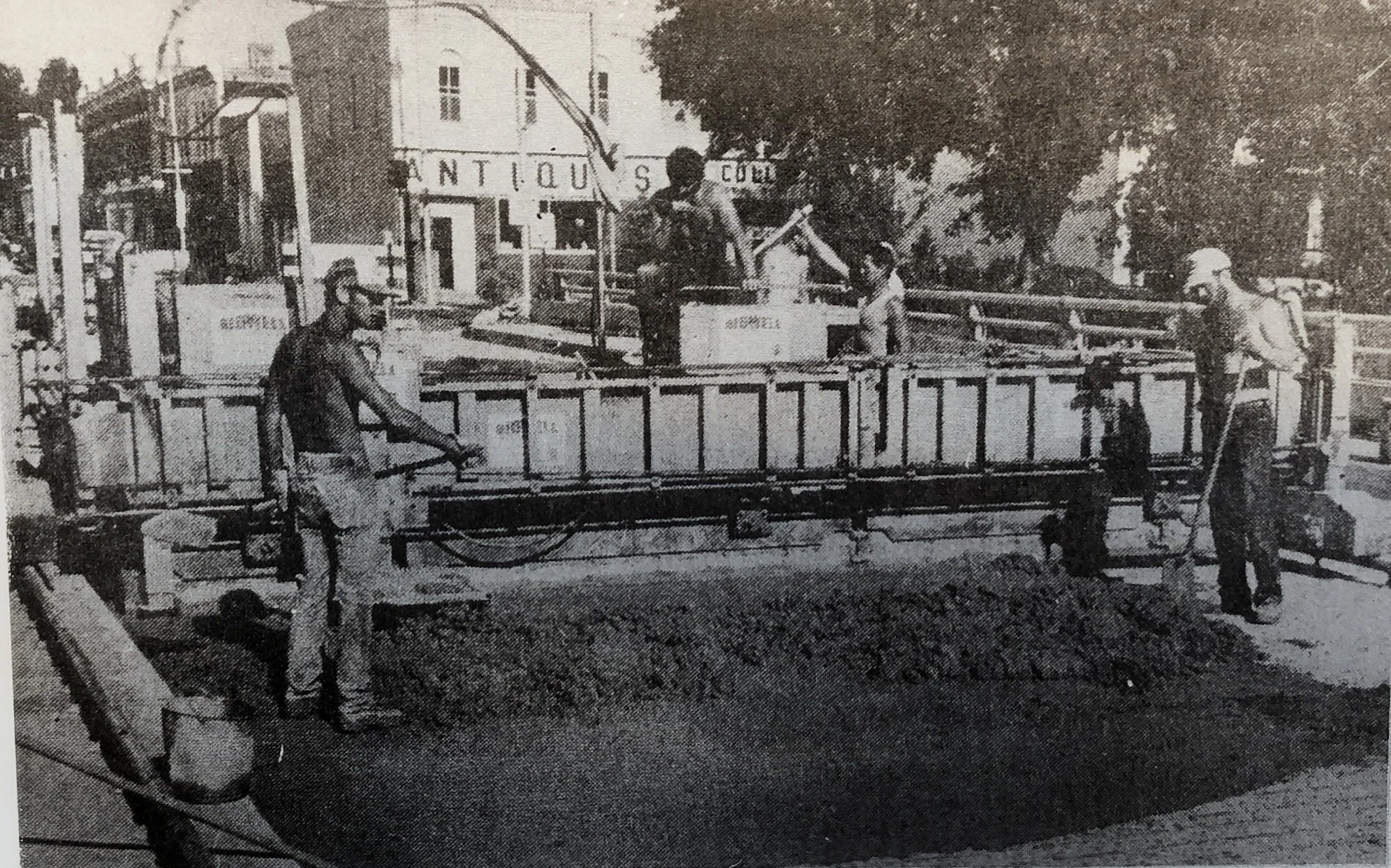
In July of 1984, the bridge received a new deck.
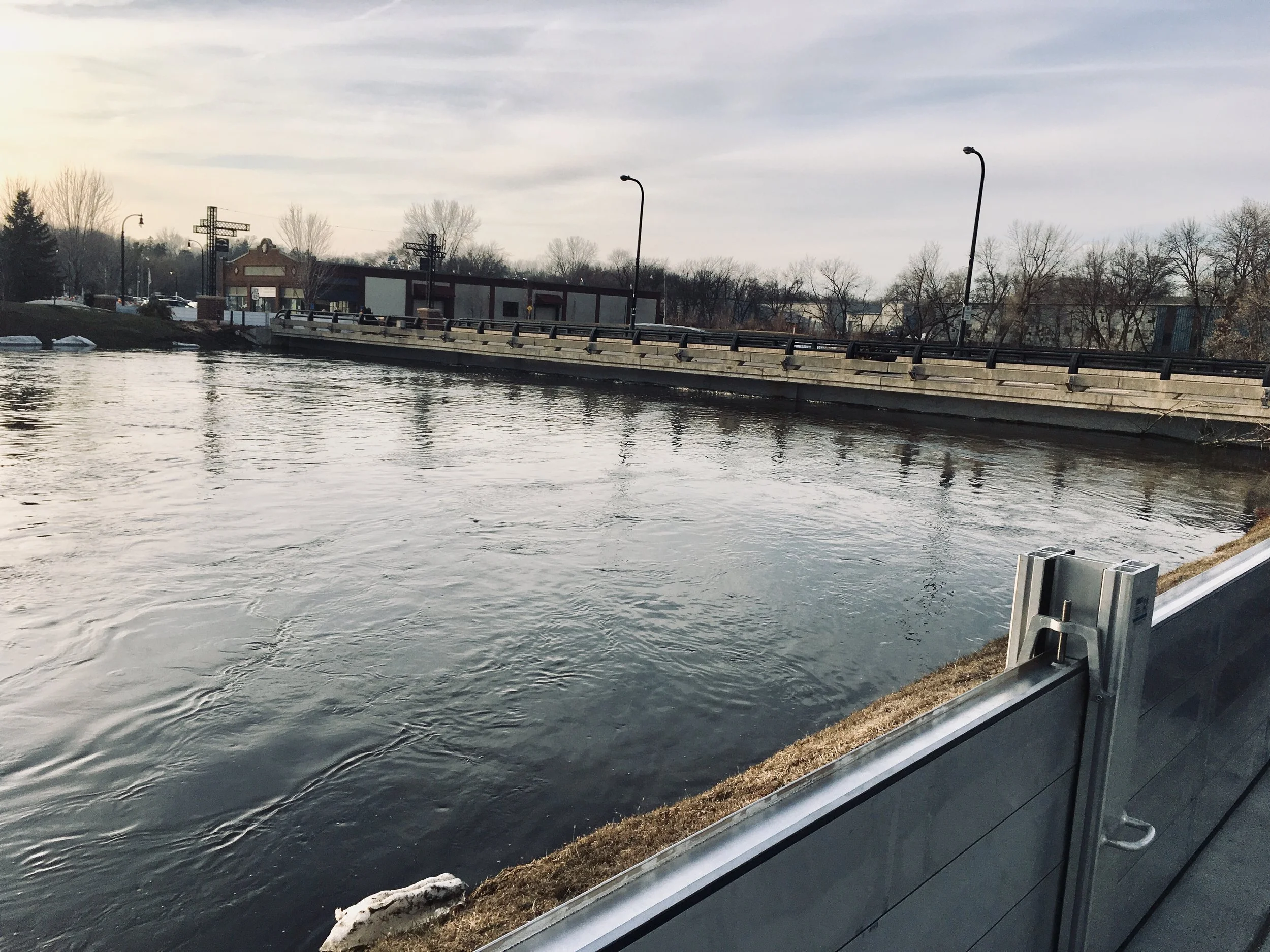
The waters of the Crow River continue to go up and down. In 2019 the bridge was closed again in March for a few days because of the high water. The new flood containment system, installed in 2015, can be seen in this photo of the bridge.
Being a river town, Delano has a long history of high water, ice dams, and flooding. It even had a dam for a short time:
In 1876, George F. Walker, who then owned the steam saw mill and grist mill first erected by Miner Ball and E. D. Barnett in 1869, put a great deal of energy, time and money into the construction of a dam across the river a short distance above the railroad bridge and attempted to run the mill with a turbine, wheel and cable. In April 1877 the ice took part of it away, the land south of town was overflowed and after a long trial, the scheme had to be abandoned. In 1878 the dam itself was abandoned.
Delano Floods
The Flood of 1897
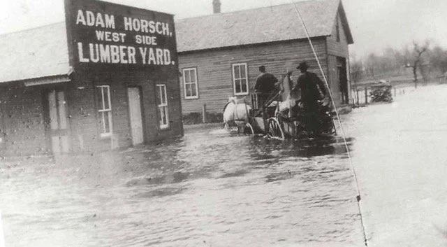
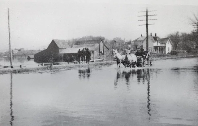
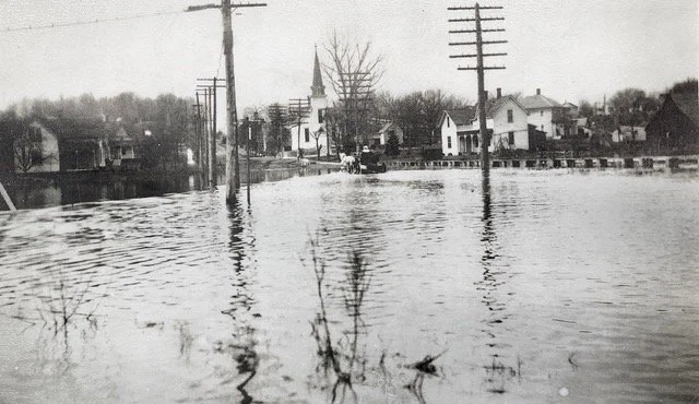
1897 When Delano was young the river flowing through it was known as the raging Crow. Since many present day residents can hardly believe the description of the river given by one of the early explorers, “A raging stream flowing between steep, gooseberry bush covered banks,” we present here an early picture of the Crow on the rampage. The picture, sent to us by Adam Horsch, shows the Crow on April 5, 1897. The lumber yard stands on the site of the present power plant. The house pictured is in the same location as the present Oscar Leiter home. The water at the time reached over what today is the state highway, and as can be seen on the wagon wheels was about two feet high at this point. The driver of the wagon was Mr. Cunningham, the Watertown dray man.
(from the Delano Eagle, May 2, 1940)
The Flood of 1916
(from the Delano Eagle, March 30, 1916)
“A number of buildings in the lower part of town, including River Street business houses, are troubled with flooded basements owing to the high stage of water in the river. The river is still rising and the water is higher than for several years. Those who have leisure time find amusement watching the ice go by and speculating on the height to which it will go. The Luce Line bridge at Watertown has been damaged and the old Rockford bridge, we are informed, has been partly swept away.”
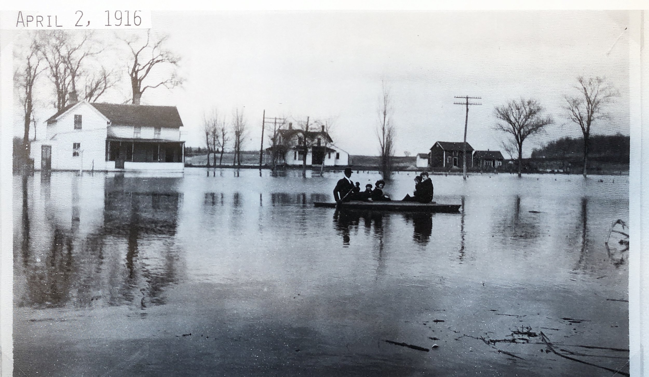
This picture was taken at the north end of Delano, near what is now Central Park.
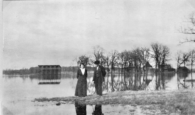
The baseball grandstand is in the background of this picture.
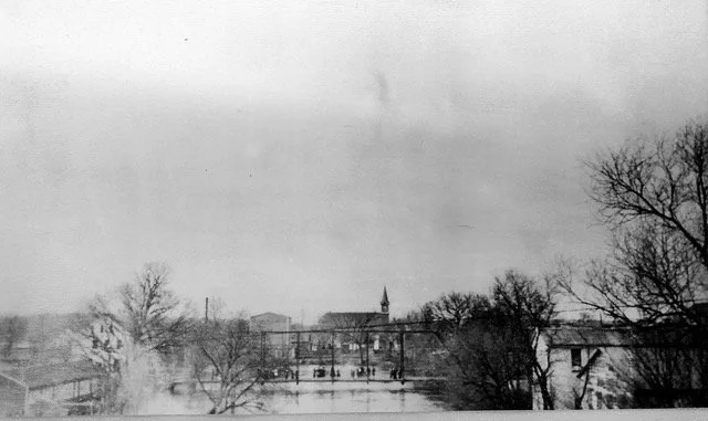
This picture was probably taken from the railroad bridge looking north, as you can see the wagon bridge, St. Joseph’s Church steeple, and the flour mill that stood where the Delano Granite Works later was located.
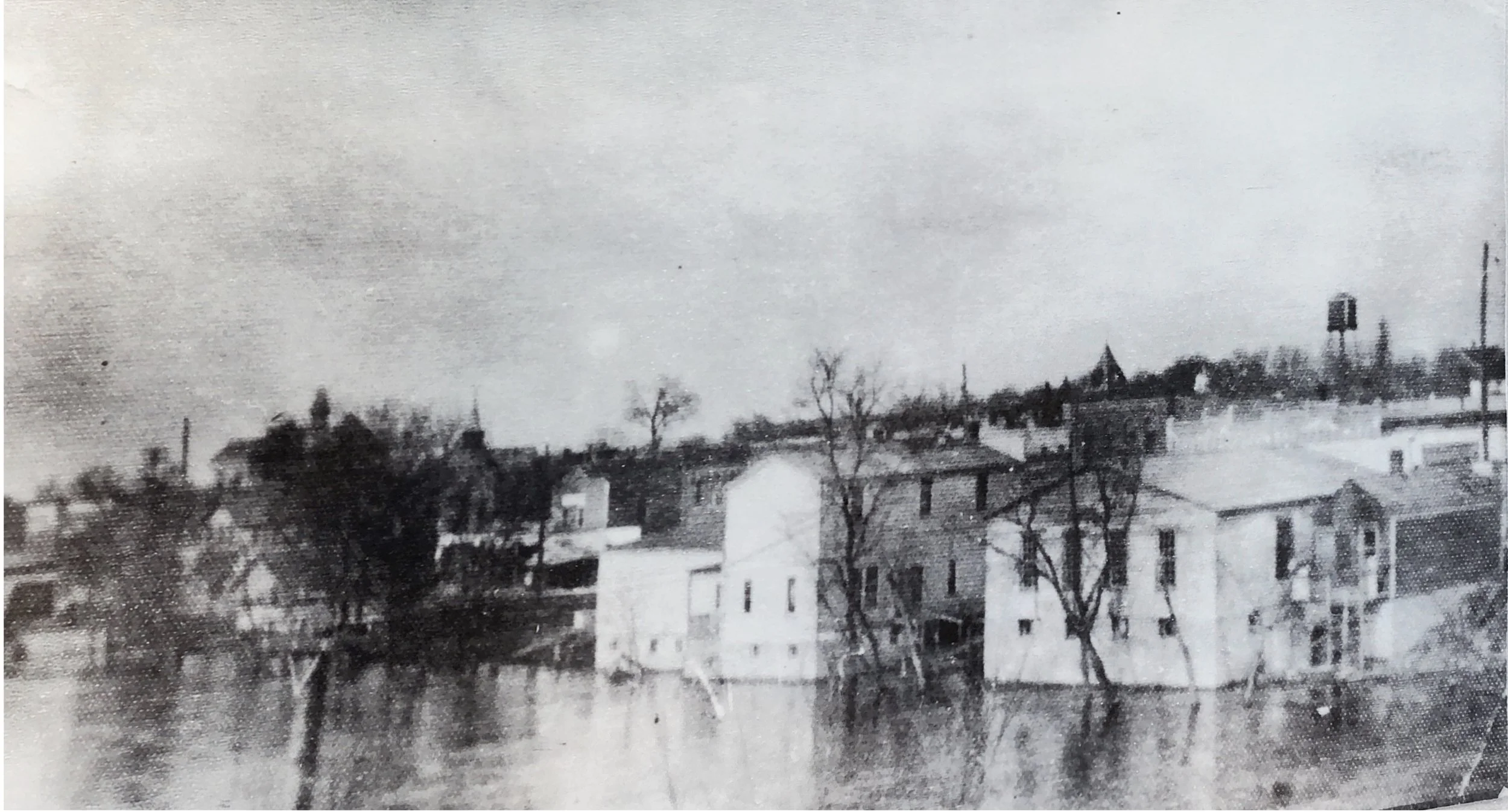
Again, this picture is probably taken from the railroad bridge. The steeple of the public school is on the left, and the city hall and water tower closer to the right. Several downtown buildings on the riverbank were in the floodwaters.
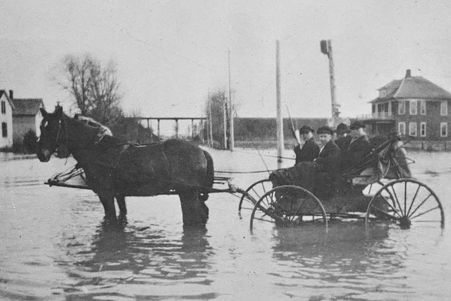
The Delano Eagle reported that during the high water several motor boats had been using the river, and on Sunday quite a number of young people enjoyed the sensation of gliding along the big stream without the effort of rowing. After the flood reached its peak, and began to subside, several of the low places around the village were still inundated and many cellars had several feet of water in them, concluding how fortunate it was that there had been no heavy rain, or considerable damage would have resulted.
Flood of 1952
From the Delano Eagle, April 10, 1952:
“Crow River Rose To An All Time High on Thursday of this week and at 2:00 o’clock press time the water was till rising. Large sections of the town are under water and 36 families have evacuated their homes. Both the wagon bridge downtown and the highway bridge had their beds awash as this was written. The wagon bridge lacked but a few inches of having the water completely cover it. All the land in the area of the park and extending south as far as Ash Street on Third Street is underwater. The river also overflowed its banks on the south end of town and River Street was flooded for two blocks, as far as Rockford Street. Bridge Street was covered with floodwaters from the power plant to the St. Paul’s Evangelical and Reformed church and part of the street was washed out by the swirling water. Most of Highway 12 from the creamery to Bridge Street was also under water and traffic was being routed around Delano.”
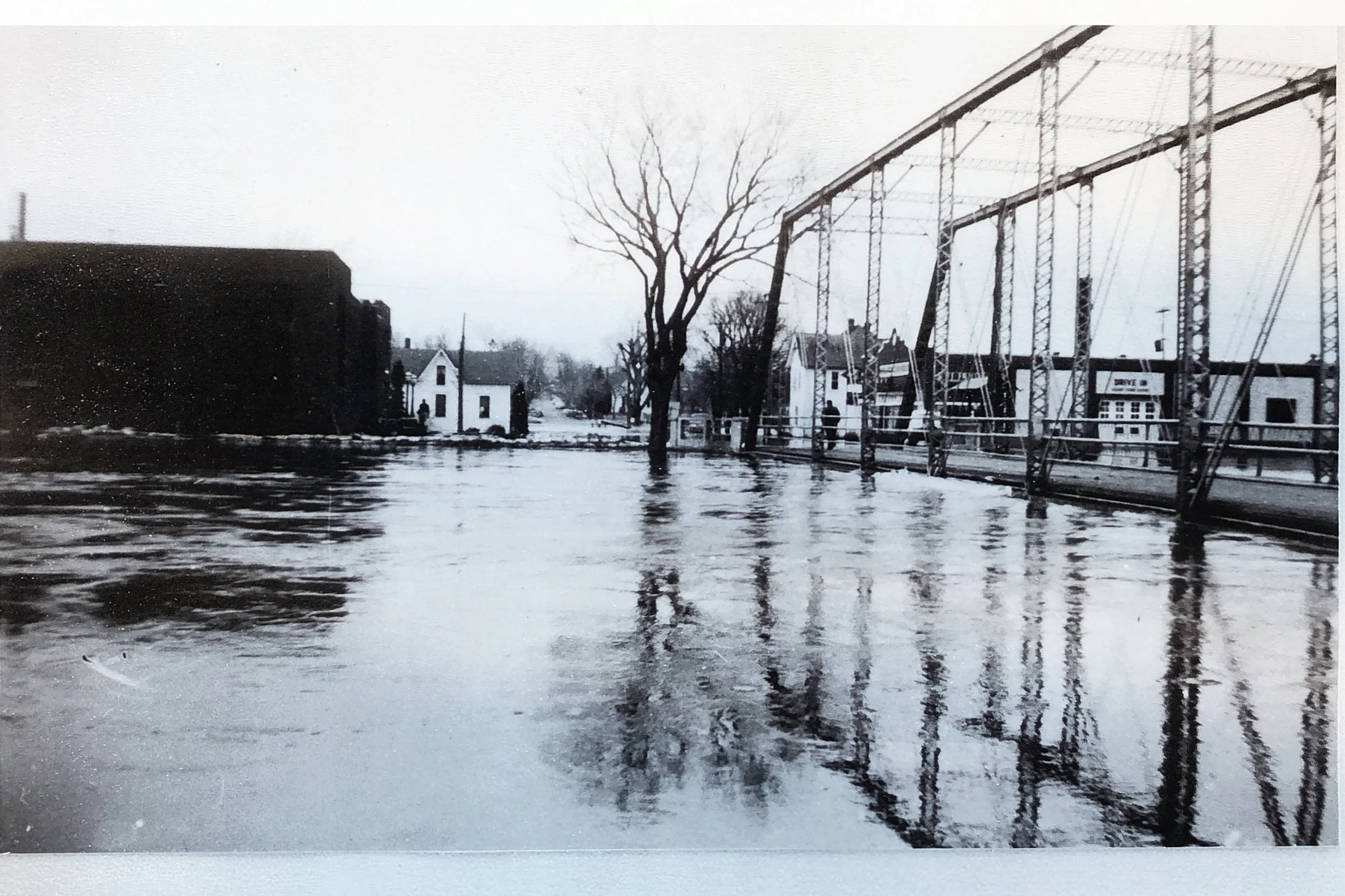
This article was published in the St. Cloud Times (St. Cloud, Minnesota) on April 11:
“The Crow River threatened the power plant and the bridge at Delano, where water is still rising. The power plant has been sandbagged. About three blocks at each end of main street is under water. The main highway bridge is holding back about a foot of water on its upstream side and a downtown bridge is taking a beating, with water just splashing on the floor of the bridge. About 40 families in the Delano area have been forced from their homes.”
Volunteer crews helped Cramers rescue their herd of cattle from their flooded barn and drove them through town to the stockyards.
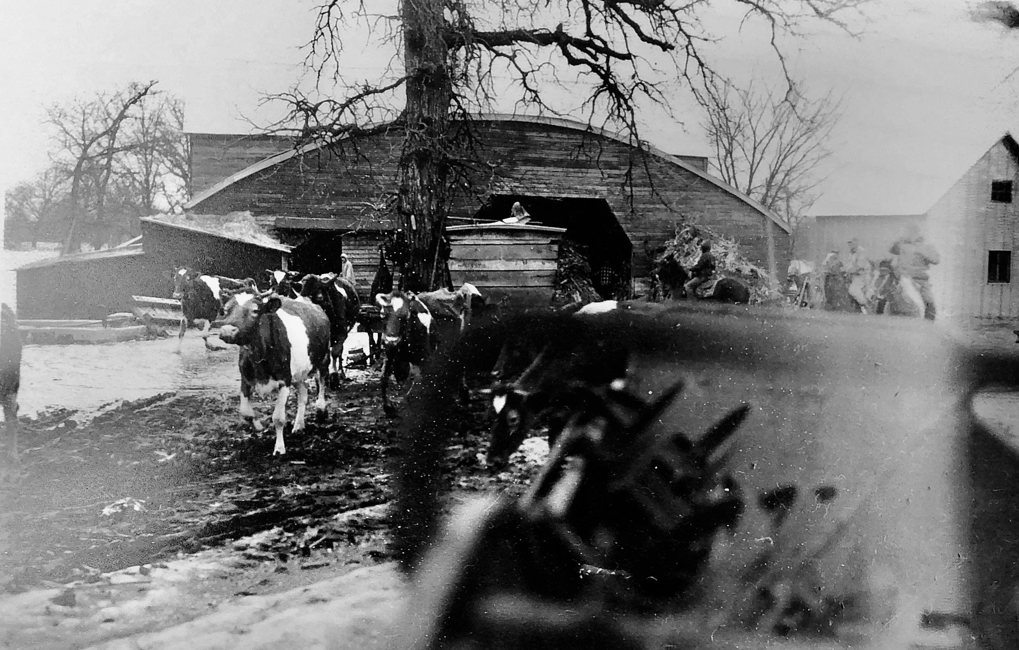
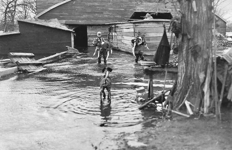
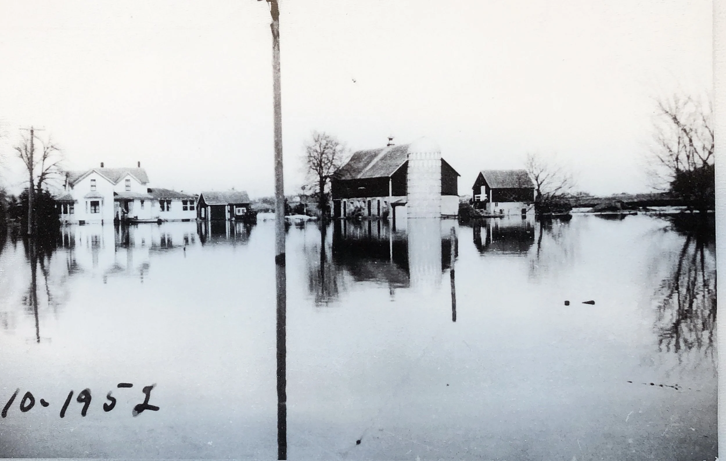
Volunteers carried calves to safety.
Other farms along the river were also evacuated.
This photo, dated 4-10-52, is the same farm shown in the 1916 flood photo. It was the Helmuth Schauer farm, located at the north end of Central Park.
The 1952 flood set an all-time record mark , and damage ran into thousands of dollars. Only a valiant effort by a crew of volunteers working around the clock saved the power plat from possible destruction. As it was, about $2000 worth of pumps were purchased to help in the fight and much repair work was needed when the waters subsided. The village also ran into considerable expenses repairing streets which were ripped part by the floodwaters, sidewalks that were undermined by the swirling currents, and cleaning up the park which became littered with flotsam.
Flood of 1957
Again, in 1957, high water on the normally placid Crow River brought forecasts that new flood records would be set for much of the length of the lower river. The crest of the 1957 flood reached Delano on June 25, at 15.7 feet, nearly a foot higher that the record set in April 1952. Only trucks and tractors were able to use Highway 12. The Crow River was about 12 feet above its normal level. The Bridge Street bridge connecting Main Street and Highway 12 was threatened. Cars were underwater in parking lots in the business district and sandbags were ineffective in some attempts to keep the Crow away from buildings near the river.
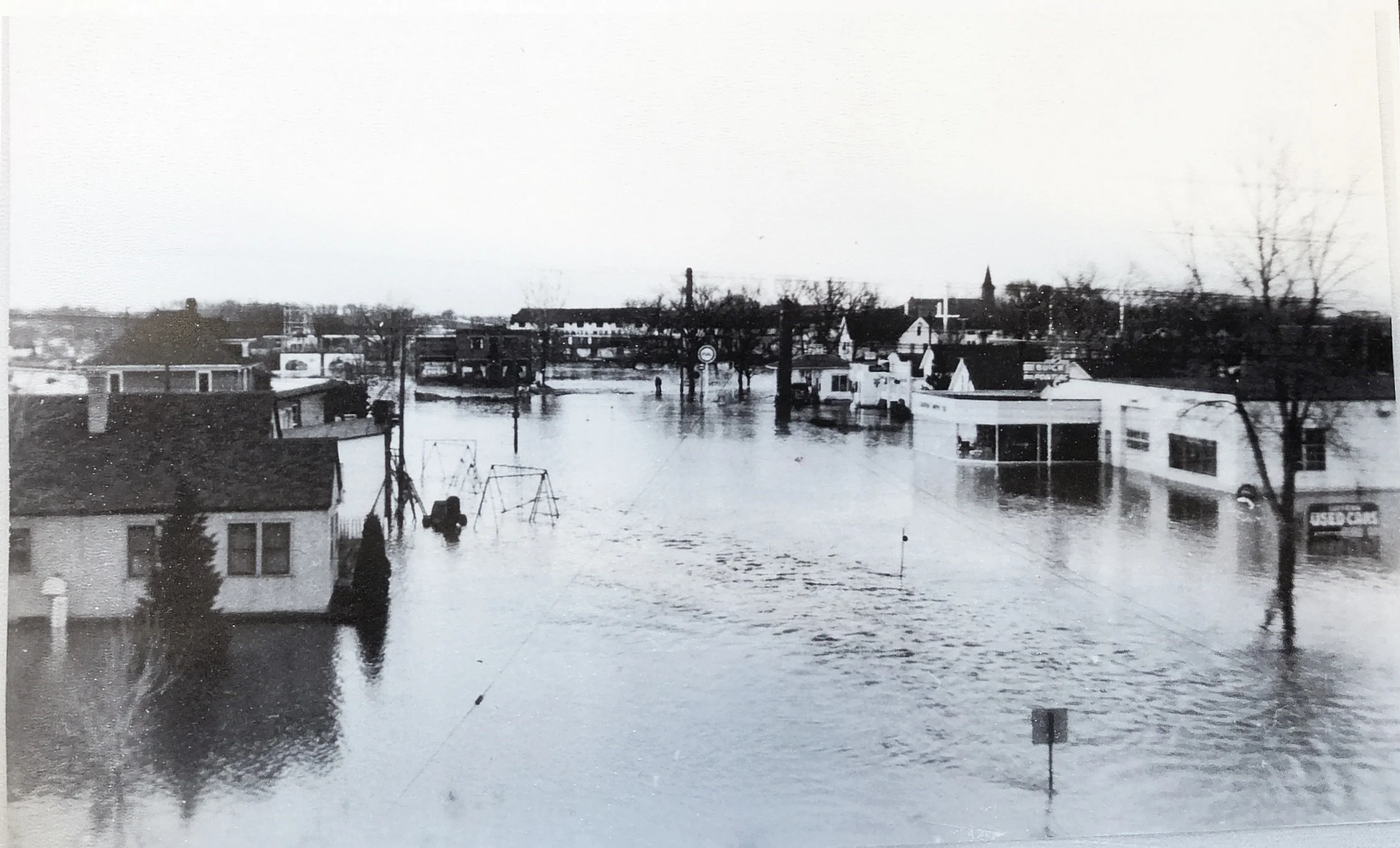
The June 27 Delano Eagle (Delano, Minnesota) proclaimed: Torrential Rains Caused An All-Time Record Flood Here sending the Crow over its banks to inundate almost half of Delano as well a hundreds of acres of farm lands along the course of the stream. The trouble began with intermittent rains during the preceding three weeks, causing the river to raise a couple of feet, but then there came a cloudburst that poured over inches of rain into the area in one afternoon. The river rose rapidly for two days, and soon left its banks in the south end of town and water started coursing through River Street. The north end of town also went under water. The water continued to raise an inch or more an hour, and crews worked around the clock to raise and strengthen sand bag dikes. The crest was reached on the fourth day, from 2 to 6 inches above the record breaker of 1952. The water at the downtown bridge was 13 feet 10 inches above the normal flow.
The Minneapolis Star (Minneapolis, Minnesota) reported that Walter Sturman, surveying the waters edging toward his house on appropriately named River Street, said ‘I’ve lived here all my 50 years and never seen it come up like this at this time of year.” Across the street, Allen Merriman was stacking cement blocks three high on his first floor. He planned to set his furniture on top, hoping the extra two feet would save it. “The water only came up 15 inches on the first floor in 1952,” he said. Next door, Mr. and Mrs. Frank Baldus had already evacuated but left their furniture behind. The water filled their basement. The home of “Tony” Boyce, Delano undertaker, stood like an island, its small parch of high ground completely surrounded by water.
Down in the center of town, the Rev. Andrew Hendzel, the pastor of St. Joseph’s Catholic church and head of the Red Cross unit in Delano, was directing operations in front of the Delano power plant. Boys of ages ranging from 8 and up worked side by side with the men to sandbag the river side of the building. Across the river, the town’s barber, Charles Bock, and his wife prepared to vacate their home behind his Main street shop at the edge of the bridge. Opening the trap door to the basement, Bock showed how all but two steps were below water. “It’s come up 7 inches in 7 hours,” said this 37-year resident of Delano. Across town on the north side, the Delano ballpark was under several feet of water. And nearby on Third Street abandoned homes included those of Richard Schultz, Elmer Witthum, Ralph Eggerglauss and Helmuth Schauer.
The St. Cloud Times reported that 35 families had been moved out.
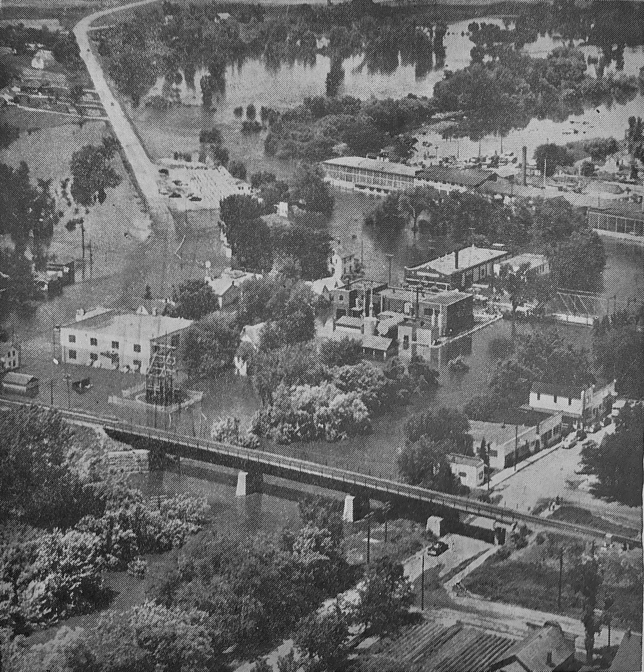
This graphic air photo of Delano’s west side taken by Powell Krueger, Mpls. Star-Tribune staff photographer, shows the extent of the flooding before the flood crest was reached. In the lower left can be seen the transformer station and Leiter’s garage, both sandbagged against the flood waters. In the middle right can be seen the sandbag dike protecting the poser plant. The Wallisch garage directly across from the power plant was also sandbagged. To the left highway 12 can be seen as it disappears under three feet of water. Lowlands below town are also shown under water.
The most recent and severe flood in Delano occurred in April of 1965. Sudden warm temperatures and rain followed heavy snow that fell in March.. The Crow reached a crest of 18.4 feet in Delano.
Flood of 1965
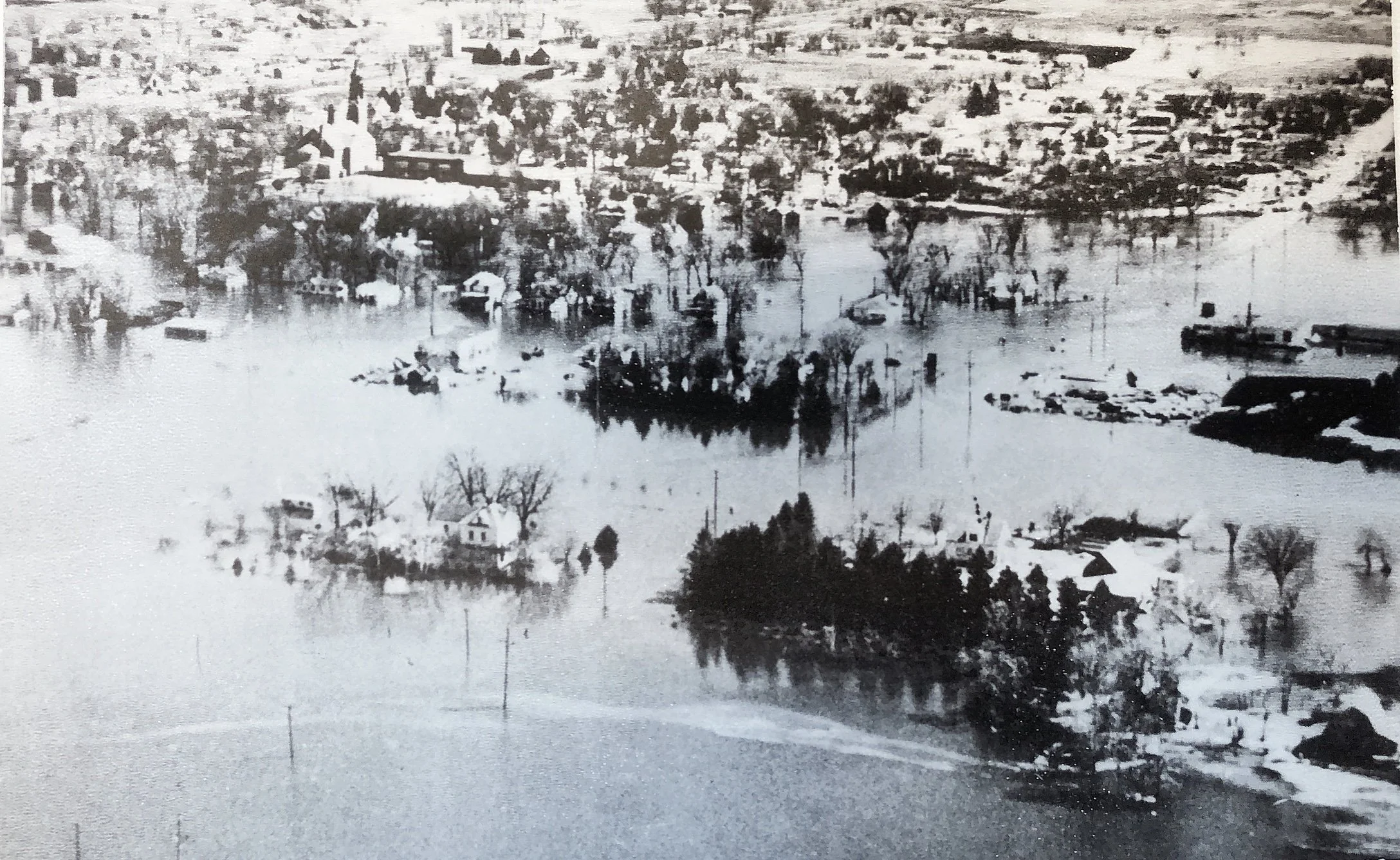
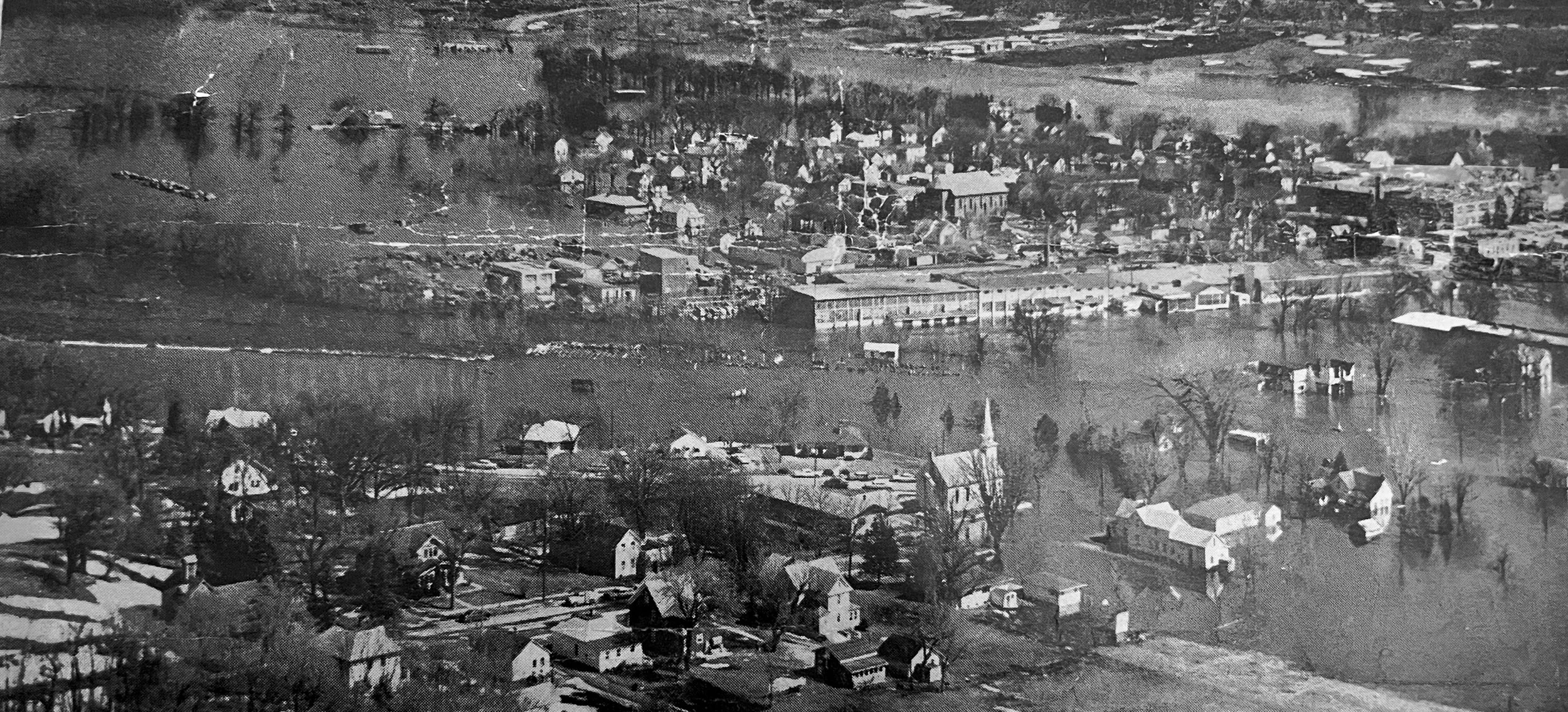
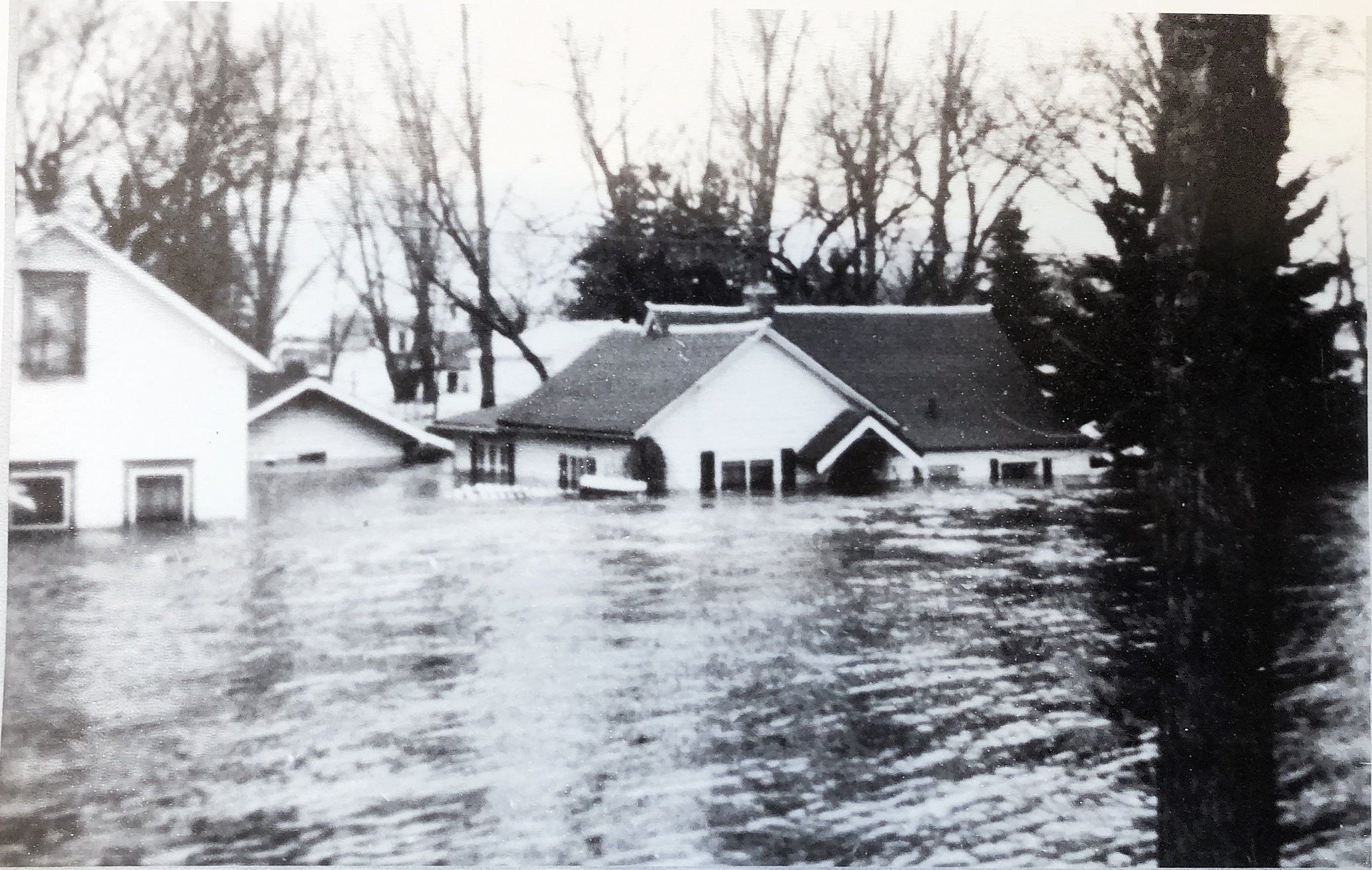
The Crow River filled up the first floors of these houses along a residential section of north River Street. The river normally runs behind the houses, but had flooded nearly half of Delano.
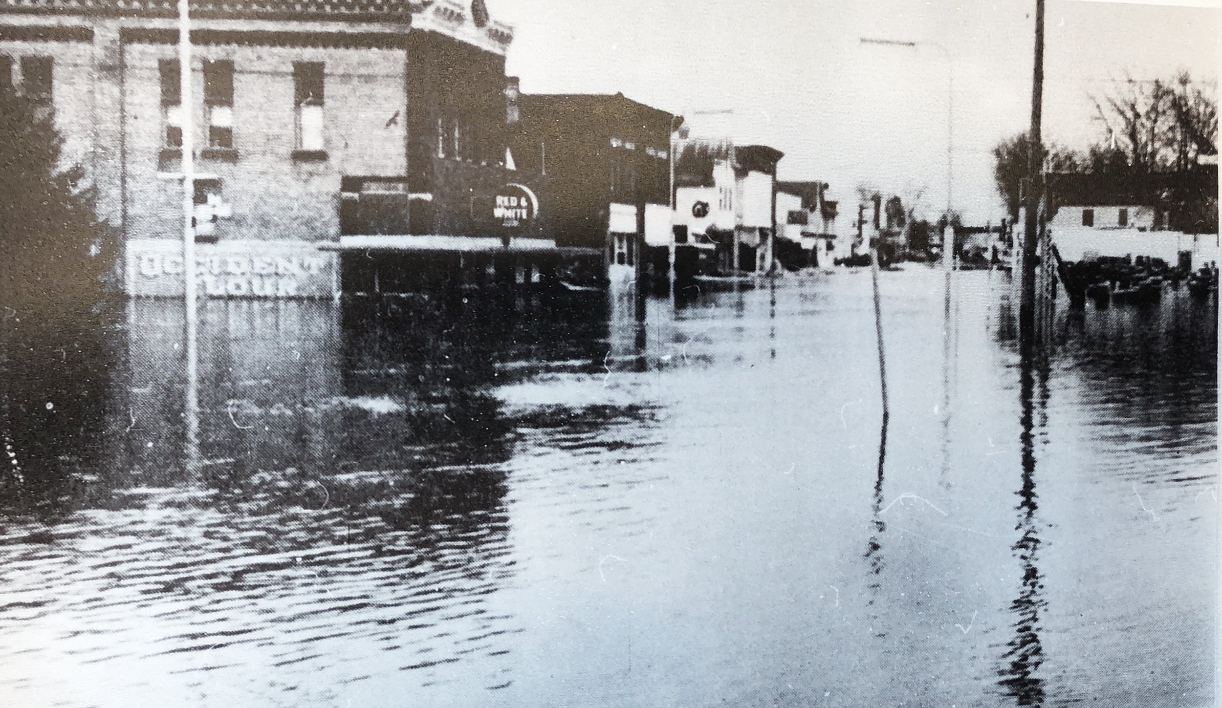
The downtown businesses were also severely flooded. Sandbagging and pumping water out of their basements back over the dike saved many of the buildings. This picture was taken at the intersection of River Street and Elm Avenue.
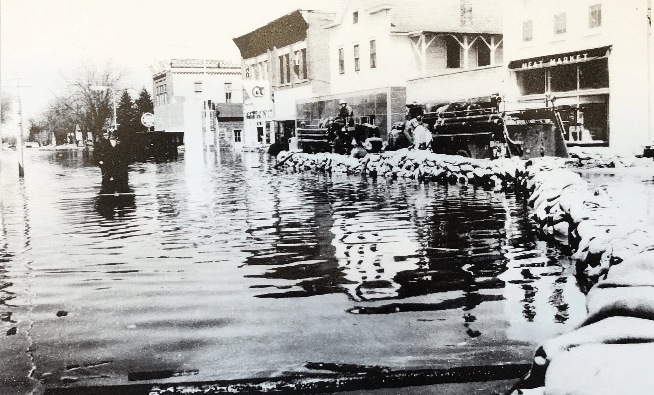
Fire departments from surrounding towns, Watertown, Montrose, Long Lake, Maple Plain, and Mound provided valuable help maintaining the dike and pumping water. 25,000 sand bags were filled and used during the flood.
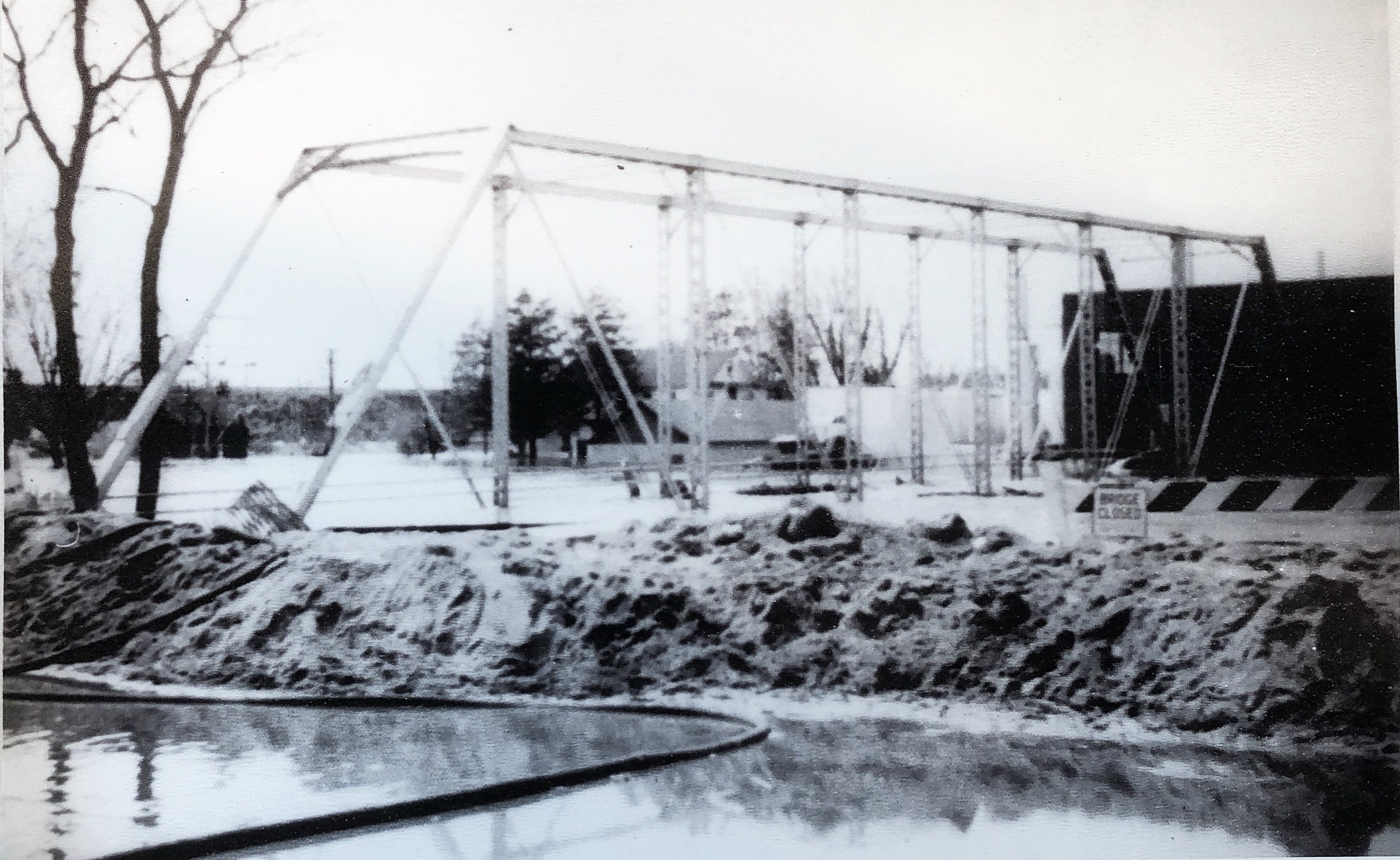
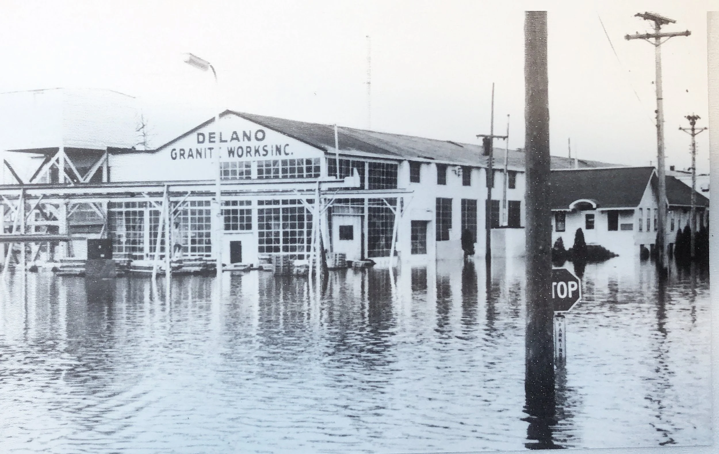
The dikes in the downtown area were about six feet high and as much as 20 feet thick. The flood waters were about two feet from the top of the dike.
On the river side of downtown, flooding was extensive.
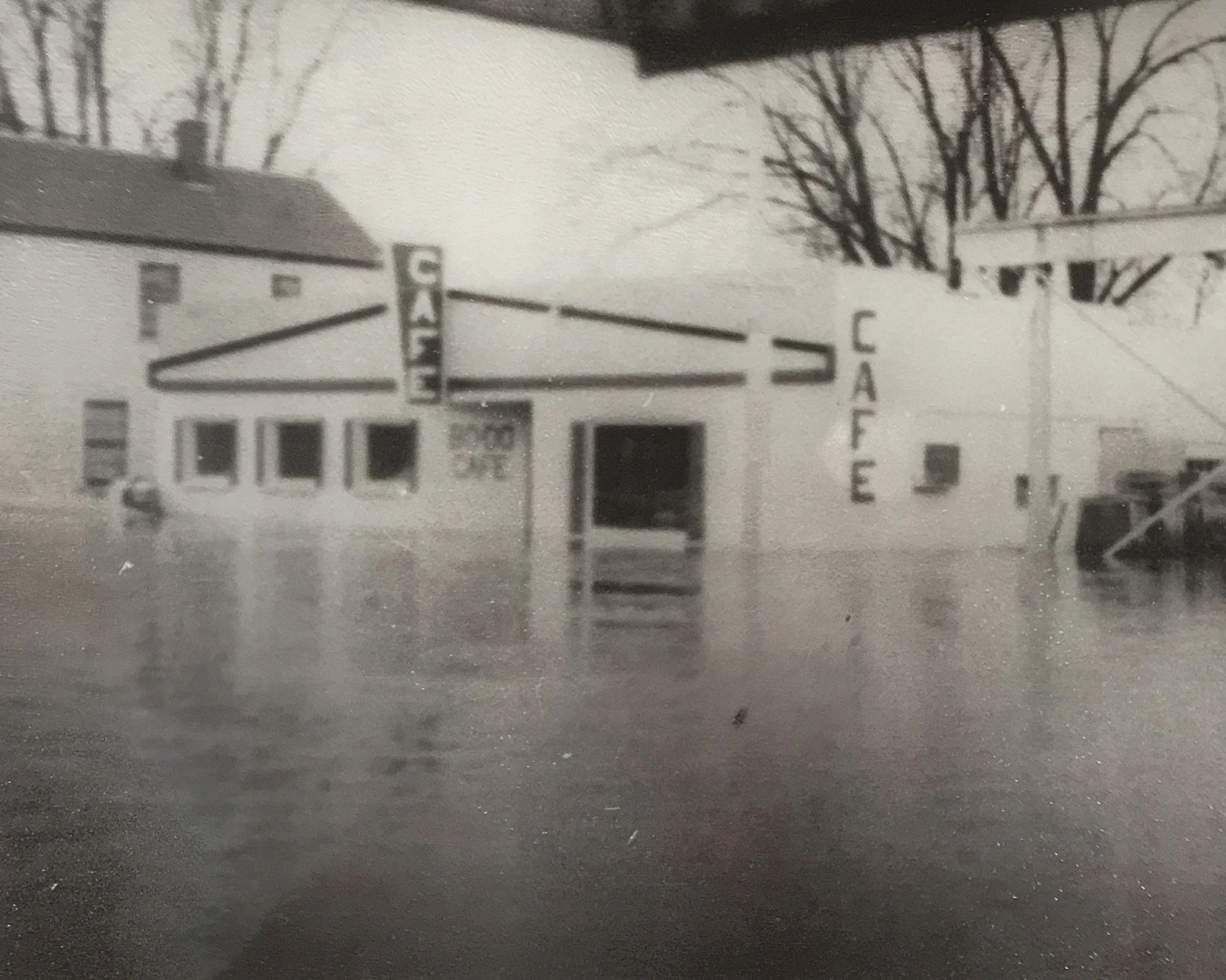
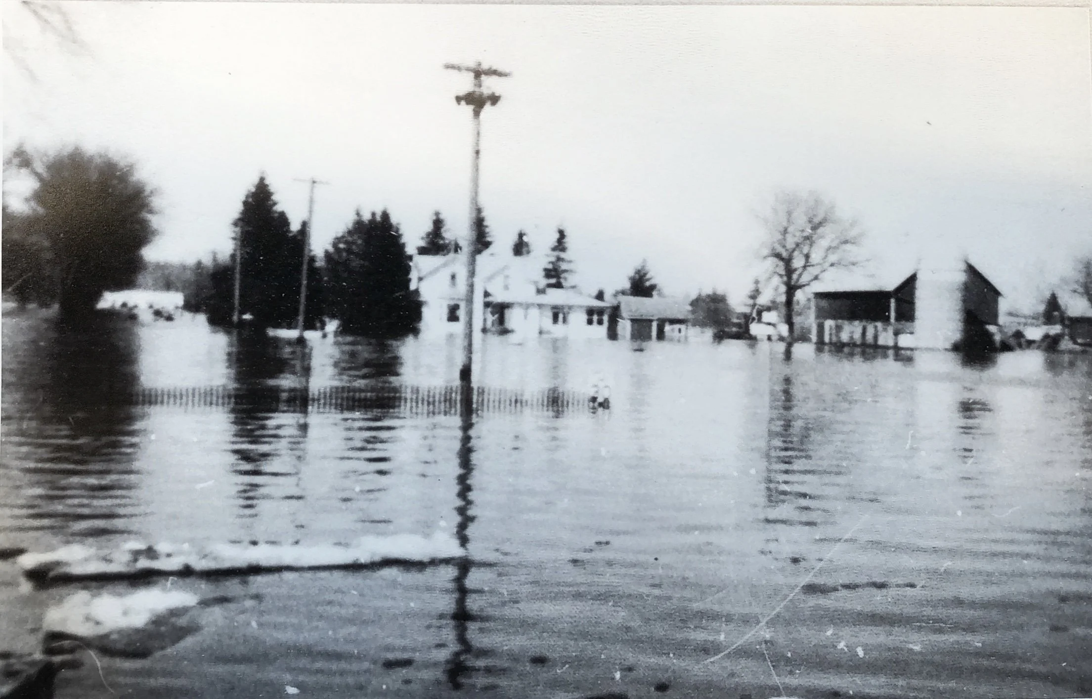
The BoDo Café had 3 feet of water on the main floor.
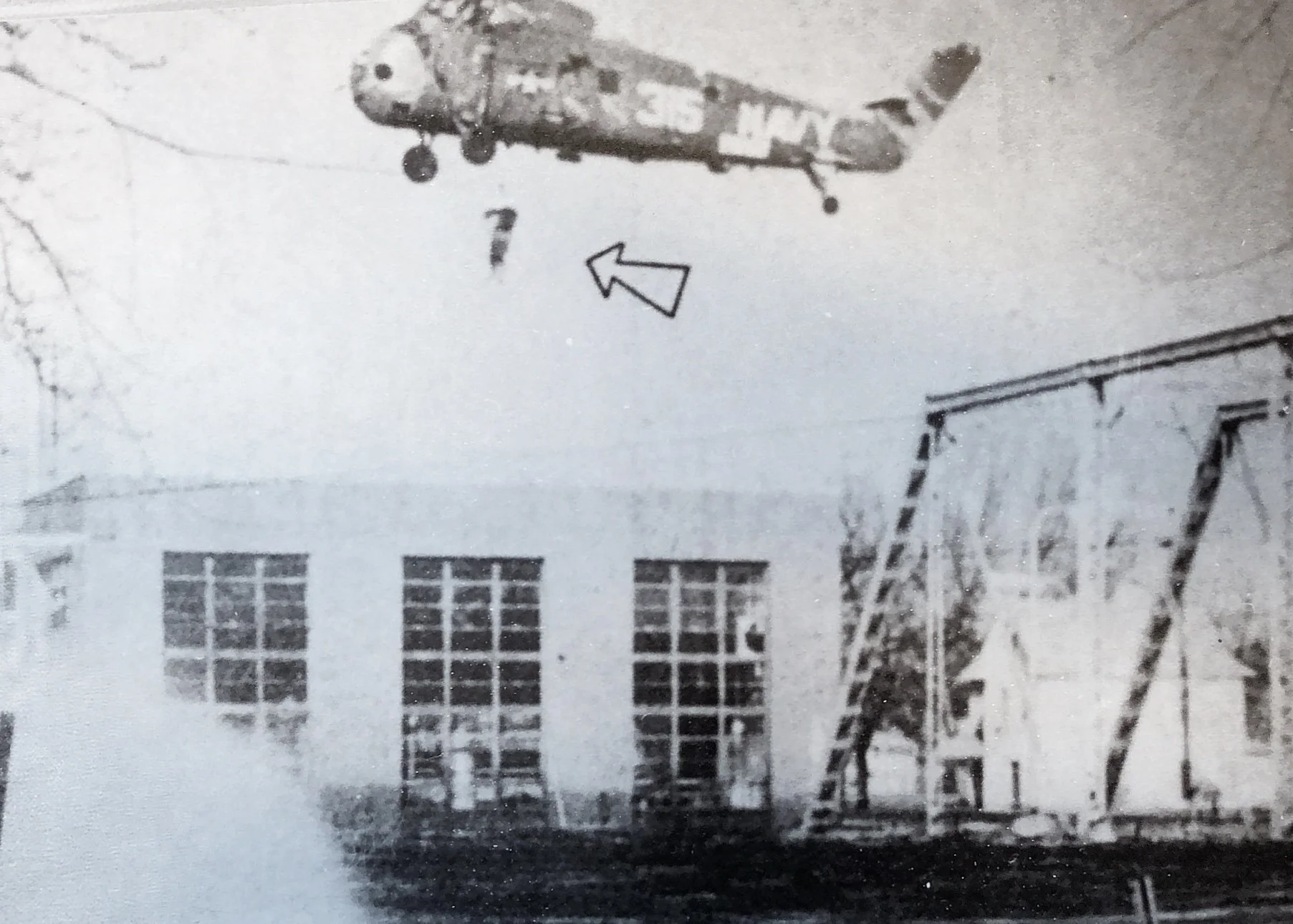
The power plant flooded, and a Navy helicopter was necessary to rescue 5 men stranded in the facility: Leonard Logston, Milton Voltin, Darwin Voltin, George Schaar and Edward Libor. The helicopter also rescued two men who were stranded at the creamery: Joseph Schaust and Anthony Bauman. The waters were too high and the current too fast for boat rescues.
And once again, the Helmuth Schauer farm, on the north end of Central Park, was in the middle of the flood. Water was reported to be almost 10 feet deep in the village park.
On April 22, the Delano Eagle reported flood damage would exceed $1,000,000.00 in the village and the immediate surrounding area, as estimated by flood disaster personnel. The heart-breaking clean-up task that followed the record-breaking flood found people returning to their flooded homes to see floors covered with inches of oil-thick muck, warped beyond repair. Wallpaper hung loosely from the walls, and drains were plugged with muck. Furniture, if caught by the rising water, was scattered in disarray, and some buildings were moved on their foundations. Roads, driveways, and lawns were deeply gouged by the swirling torrents and over much of the flooded area were covered with a layer of rocks, sand, and silt. Debris was everywhere: parts of buildings, tree stumps, sings, logs, cans, fuel ranks, and an almost unbelievable amount of brush and weeds. The force of the torrent was graphically illustrated at the Granite Works highway display yard where monuments weighing up to a thousand pounds were tipped and scattered as though they were paper boxes. But as was the case during the actual flood, when help poured into the area from all over, offers came in to help in the cleanup task.
High melt-off waters were predicted in March of 1969. The Delano Village Council had developed a plan to remove by ammonium-nitrate blasting, several Crow River sandbars which would slow the flow of water and impede floodwater runoffs. But what was really needed was a permanent solution to the flood problem. Delano applied for, and qualified for pre-disaster funds. Work began on March 20 on earthen dikes to protect Delano from the impending spring flood.
Flood of 1969
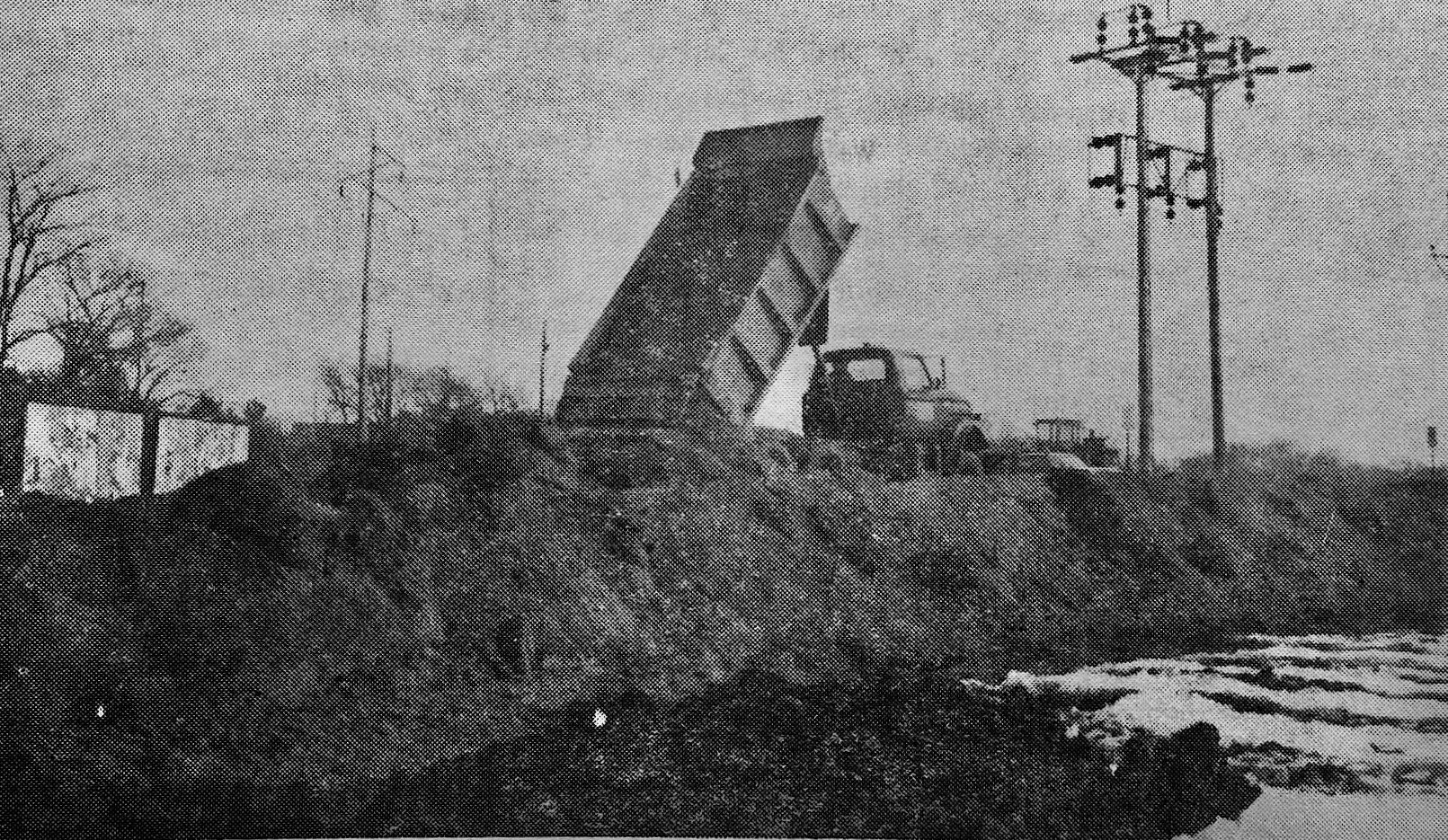
The Minnesota Highway Department in cooperation with the village of Delano and the U S. Corps of Engineers built 8,600 feet of dikes along both sides of the Crow River. Crews worked around the clock to complete the job by April 1. The diking and flood control project was possible with a $111,641 grant from the U. S. Corps of Engineers and an estimated expenditure of $50,000 by Delano. In addition, volunteers laid polyethylene and sandbags to keep the plastic in place on the dikes.
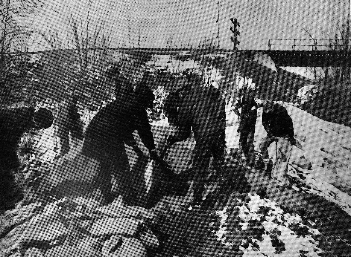
The Crow crested at 15.6, similar to that of the 1952 and 1957 floods, on April 11 1969, with the big news being that there was a lack of real damage done as compared to those former flood years. During the preceding week there had been constant dike patrols watching for wear and tear on the dikes, checking breaks, leaks and seepage, and constant pumping of those basements still filling with water.
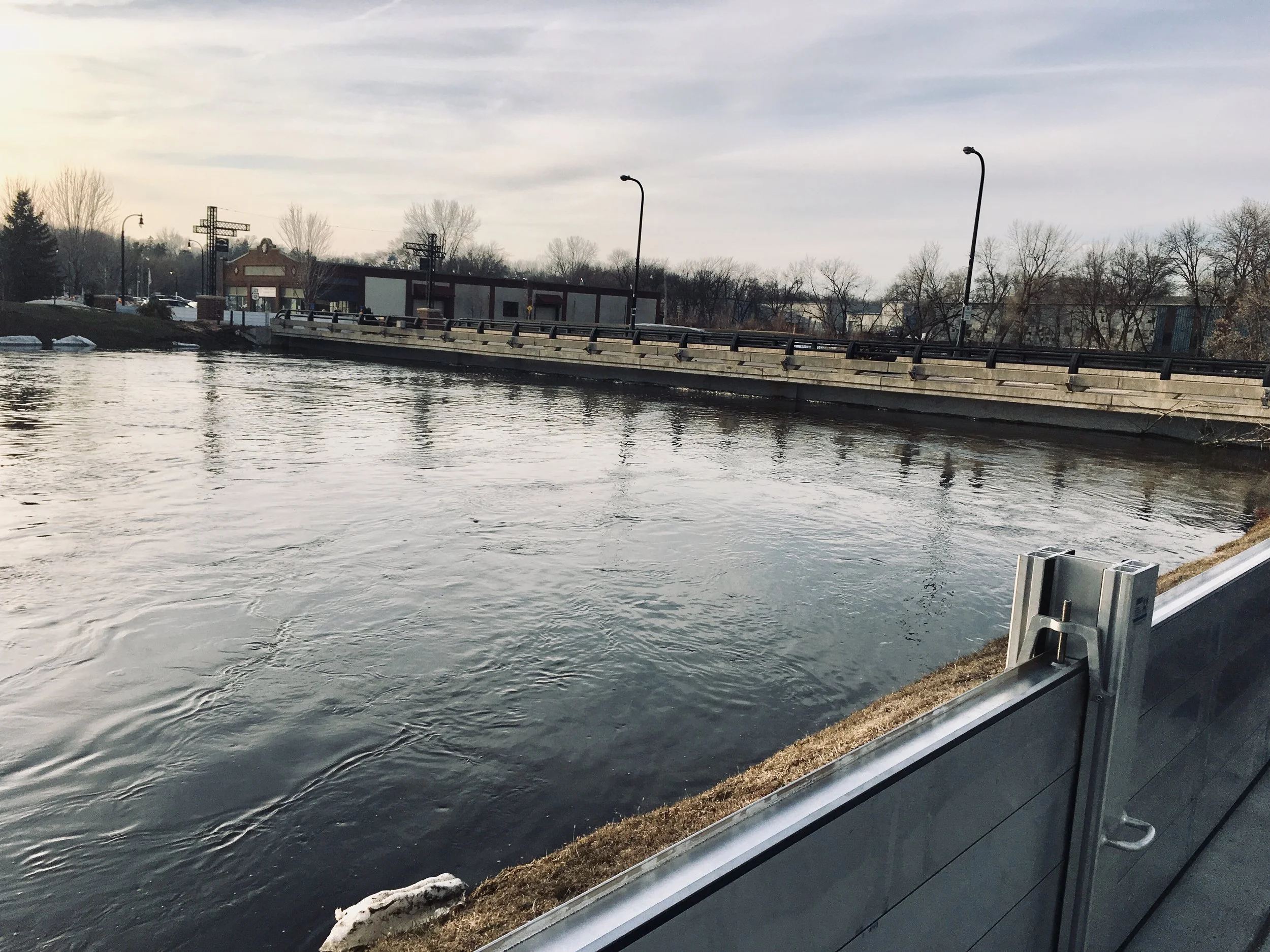
In 2015, after over a century of flooding conditions which occasionally ravaged community homes and businesses, a flood containment system was installed along the river bank in order to protect the downtown district. It is comprised of a large underground footing system that supports removable walls which can be installed when needed.
High water March 23, 2019 caused the bridge to be closed, and the walls installed.

The content of this page is brought to you by the Delano Spirit of Community Trail Committee in honor of Delano's 150th Anniversary.